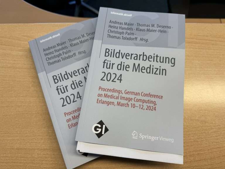
Index

Differentially Private Federated Learning for Multilabel Classification of Chest Radiographs

Data Augmentation for Artwork Object Detection via Latent Diffusion Models

Masterarbeit_proposal_DA_2310

Enhancing Retrieval-Augmented Generation Systems with Fine-Tuned Language Models for Dynamic Technical Documentation

Generation of IEC 61131-3 SFCs conditioned on textual user intents and existing sequences

Real-World Constrained Parameter Space Analysis for Rigid Head Motion Simulation

Description

In recent years, the application of deep learning techniques to medical image analysis tasks and image quality enhancement has proven to be a useful tool. One critical area where deep learning models have shown promising results is for patient motion estimation in CT scans [1],[2].

Deep learning models highly depend on the quality and diversity of the underlying training data, but well-annotated datasets, where the patient motion throughout the whole scan is known, are sparse. This is typically overcome with the generation of synthetic data, where motion-free clinical acquisitions are corrupted with simulated patient motion by altering the relevant components in the projection matrices. In the case of head CT scans, the rigid patient motion can be parameterized by a 6DOF trajectory over all acquisition frames. This is typically done by applying a Gaussian motion or, for more complex patterns, using B-splines. However, these simulated patterns often fall short of mimicking real head motion observed in clinical settings, especially by lacking complex spatiotemporal correlations. To provide more realistic training samples it is necessary to define a real-world constrained parameter space, respecting correlations, time dependencies and anatomical boundaries. This allows for neural networks to generalize better to real-world data.

This thesis aims to perform a conclusive analysis of the parameter space of rigid (6DOF) head motion patterns, obtained from measurements with an in-house optical tracking system integrated in a C-arm CT scanner at Siemens Healthineers in Forchheim. By analyzing the spatiotemporal correlations and constraints in the 6DOF parameter space, lower-dimensional underlying structures might be uncovered. Clustering techniques can be incorporated to further reveal sub-manifolds in the 6DOF space, as well as distinguishing different classes of motion types like breathing, nodding, etc. A Variational Autoencoder (or similar) should be trained with the goal of providing annotated synthetic datasets with realistic motion patterns.


[1] A. Preuhs et al., “Appearance Learning for Image-Based Motion Estimation in Tomography,” in IEEE Transactions on Medical Imaging, vol. 39, no. 11, pp. 3667-3678, Nov. 2020

[2] Chen Z, Li Q, Wu D., “Estimate and compensate head motion in non-contrast head CT scans using partial angle reconstruction and deep learning,” in Medical Physics 2024; 51: 3309–3321

FVR-ADNeRF: Attention-Driven NeRFs for Few-View Reconstruction to enable CT Trajectory Optimization

Leveraging Large Language Models for Scanner-Compatible CT Protocol Generation

Dynamic Cloud Classification through Neural Networks: Integrating Video Analysis and PV Monitoring Data

Real-Time Traffic Sign Detection for Smart Data Logging

CZ_MT_Proposal_v2

Deep Learning for Geo-Referencing Historical Utility Documents With Geographical Features

Abstract:

The digitization of industries has spurred significant advancements across sectors, including utilities responsible for essential services like heating and water supply. As many utility systems developed before the digital era, they hold immense potential for optimization through digital representation. Accurate mapping of their extensive underground pipeline networks is key to improving operational efficiency. However, this digitization presents challenges, primarily because extracting geographic information from historical planning documents is difficult, as the infrastructure remains buried underground.

In this work, we propose a two-stage deep-learning framework to extract geographic information from historical utility planning records and facilitate the digital representation of utility networks. During the first stage, we frame this as a geo-location classification task, using a Convolutional Neural Network (CNN) to classify OpenStreetMap images into specific geographic regions covered by the utility network. In the second stage, we address the scarcity of annotated data by applying a style-transfer technique to historical documents containing geographic features, converting them into a format similar to OpenStreetMap images. This process enables further classification using the trained CNN. We will evaluate the method on real-world utility data.


This thesis is part of the “UtilityTwin” project.